Managing fleet operations sounds simple until the number of trips starts growing.
A logistics company may have hundreds of vehicles on the road every day. Some travel between warehouses. Others make customer deliveries or visit service locations. Keeping track of the purpose of every trip soon becomes a challenge.
Many businesses still rely on drivers or fleet managers to classify trips manually. It may seem like a small task, but over time it creates bigger problems. Trips get labelled incorrectly. Some are left unclassified. Reports become inconsistent, and managers spend extra time fixing records instead of using them.
This is where automation can make a real difference.
Instead of asking someone to classify every journey, modern fleet management software can do it automatically. One of the simplest ways to achieve this is through geofence-based trip classification.
In this blog, we’ll look at how this approach works, why it improves fleet accuracy, and why it is becoming an important feature for businesses that want smarter fleet operations.
When Small Errors Turn Into Bigger Problems
Let’s say a company operates 80 delivery vehicles.
Each vehicle completes six to eight trips every day. By the end of the week, hundreds of trips have been recorded.
Now imagine that only a few of those trips are classified incorrectly. One delivery trip is marked as an internal transfer. A warehouse movement is recorded as a customer visit. A service trip is not classified at all because the driver forgot to update it.
These may look like small mistakes. But when they happen every day, they start affecting the bigger picture.
The reports no longer show what is really happening on the road. Managers spend time checking routes instead of analysing performance. Different teams end up working with different information, making it harder to plan operations with confidence.
The problem is not that people are careless. The problem is that manual processes become difficult to manage as operations grow.
Businesses Need Data They Can Trust
Fleet management is no longer just about knowing where a vehicle is. Businesses want to understand how their vehicles are being used. They want to know how many delivery trips were completed, how often vehicles moved between warehouses, and whether service vehicles followed their planned routes.
This information helps managers make better decisions. But these decisions are only as good as the data behind them.
If trip records are incomplete or inconsistent, reports lose their value. Instead of helping managers improve operations, they create more questions.
This is why many businesses are looking for ways to remove manual work from their daily operations.
A Smarter Way to Classify Trips
One practical solution is geofence-based trip classification. Before understanding how it works, let’s first understand what a geofence is.
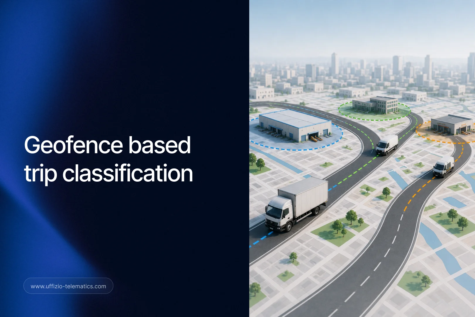
A geofence is simply a virtual boundary created around a location. It could be a warehouse, a depot, a factory, a customer site, or any place that is important to your business.
Once these locations are defined, the fleet management software starts recognising vehicle movement between them.
For example, if a vehicle leaves Warehouse A and reaches Customer Location B, the system can automatically identify it as a delivery trip. If another vehicle travels from a factory to a distribution centre, it can be classified as an inventory transfer.
No one has to remember to update the trip. The software does the work automatically.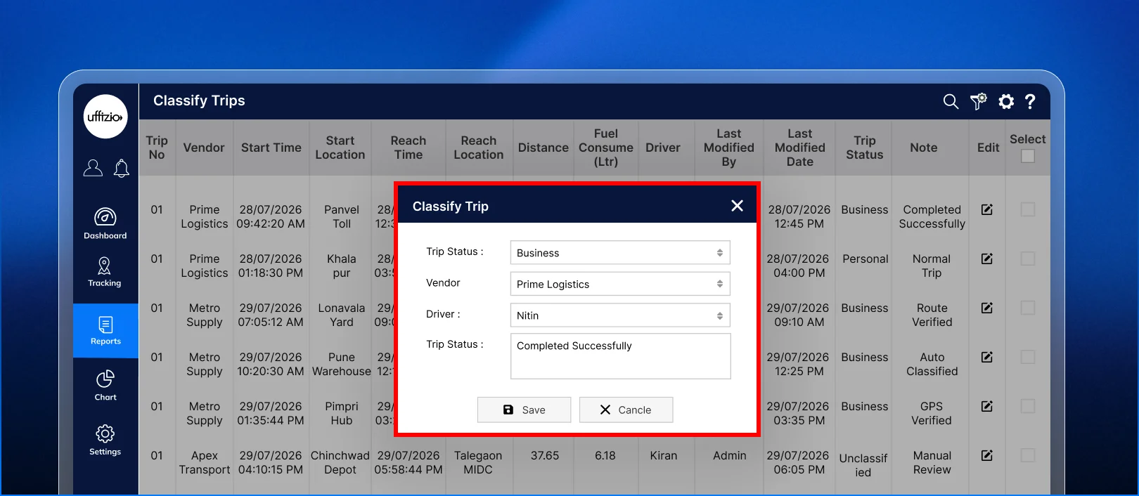
Accuracy Improves Without Adding More Work
The biggest advantage of geofence-based trip classification is that it improves accuracy without increasing anyone’s workload.
Drivers can focus on driving instead of updating trip records.
Fleet managers no longer need to spend hours checking whether trips have been classified correctly.
Since every trip follows the same rules, the information remains consistent across the system.
This consistency becomes especially useful when businesses operate across multiple locations. Whether there are ten vehicles or a thousand, every trip is classified using the same logic.
That means reports become easier to trust.
Better Reports Lead to Better Decisions
Accurate trip classification has a direct impact on reporting. When every trip is correctly identified, businesses can clearly understand how their fleet is being used.
They can compare delivery operations across different regions. They can identify which routes are used most often. They can analyse vehicle movement between warehouses and monitor different types of trips separately.
These insights make planning much easier.
Instead of spending time correcting reports, managers can focus on improving productivity, reducing unnecessary travel, and making better use of fleet resources.
In simple words, better data leads to better decisions.
Why This Matters for System Integrators and Resellers
Customers today expect more than vehicle tracking. Most businesses already know how to see a vehicle’s live location. What they really want is software that helps them reduce manual work and improve everyday operations.
This creates a great opportunity for system integrators and resellers.
Rather than presenting geofence-based trip classification as just another feature, you can present it as a business solution.
It helps customers automate repetitive tasks. It improves reporting accuracy.
It reduces human errors. And it gives managers more confidence in the information they use every day.
These are business benefits that customers immediately understand because they solve problems that many of them already face.
How Trakzee Helps
To make trip management more intelligent, Trakzee now supports geofence-based trip classification.
Users can configure one or multiple start and end geofences based on their business operations. Whenever a vehicle travels between those locations, the system automatically applies the selected trip classification.
The platform also records how the trip was classified, whether through geofence rules, schedule-based rules, or manual classification. This gives fleet managers better visibility while reducing the effort required to maintain accurate trip records.

Final Thoughts
As fleet operations expand, manual processes become harder to manage.
Something as simple as classifying trips can slowly turn into a time-consuming task that affects reporting accuracy across the business.
Geofence-based trip classification solves this problem in a practical way. It removes repetitive work, keeps trip data consistent, and helps businesses rely on reports that truly reflect their daily operations.
For system integrators and resellers, this feature is more than an addition to a product. It is a valuable solution that helps customers save time, improve operational visibility, and make better business decisions.
As businesses continue looking for smarter ways to manage their fleets, automation features like geofence-based trip classification will become an important part of every modern fleet management solution.