Imagine a farm manager reviewing an entire day’s field activity.
Several tractors have been working across multiple fields. Some fields were cultivated. Others were harvested. The manager now needs to understand what happened, how much area was covered, how much time was spent, and how efficiently the equipment operated.
Traditionally, this process takes time.
The manager must replay vehicle movement, identify the field boundaries manually, draw them on a map, and then calculate the area covered. When there are multiple fields involved, the task becomes even more challenging.
This is where AI is changing the way farm operations are monitored.
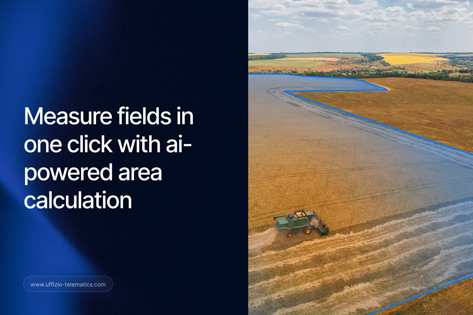
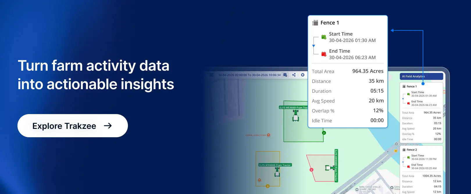
With the latest enhancement in Trakzee by Uffizio, users can now perform AI Field Measurement directly from Playback. Instead of manually measuring fields, the system automatically detects farming activity, identifies field boundaries, and generates field-wise analytics with just a single click.
Let’s explore how this new capability makes Farm Field Monitoring easier, faster, and more accurate.
The Challenge with Traditional Field Measurement
For many agricultural businesses and equipment operators, understanding field activity is critical.
They need answers to questions such as:
- Which field was worked on?
- How much area was covered?
- How long did the operation take?
- How far did the equipment travel?
- Were all assigned fields completed?
Getting these answers manually often involves several steps.
An operator needs to examine GPS playback data, identify work zones, draw field boundaries, and calculate measurements separately. This process is not only time-consuming but also prone to human error.
For organizations managing dozens or even hundreds of fields, manual measurement can become a major operational burden.
As agricultural operations continue to grow, businesses need a smarter way to monitor field activities.
Introducing AI Field Measurement in Trakzee
To simplify this process, Trakzee now offers AI Field Measurement within the Playback module.
This enhancement uses artificial intelligence to analyze vehicle movement and automatically identify farming activities.
With a single click, the system can:
- Detect farming activity automatically
- Identify active field areas
- Draw field boundaries on the map
- Calculate area covered
- Measure travel distance
- Calculate operation duration
The result is instant visibility into field operations without any manual effort.
Instead of spending valuable time measuring fields, users can focus on making better operational decisions.
How It Works
The process is simple and user-friendly.
A user opens the Playback section and selects the required vehicle and time period.
Once playback data is available, the new AI Field Measurement option can be activated.
The AI engine then analyzes movement patterns and identifies areas where farming activities have taken place.
After processing the data, the system automatically generates:
Field Boundaries
The platform detects the actual working area and outlines the field directly on the map.
Area Covered
Users can instantly see how much land has been cultivated, harvested, or serviced.
Distance Travelled
The system calculates the total distance covered during field operations.
Time Spent
The duration of activity within each field is automatically measured.
Everything is presented visually and clearly, making it easy to understand field performance at a glance.
Managing Multiple Fields Becomes Easier
One of the most valuable advantages of this enhancement is the ability to analyze multiple fields separately during a single playback session.
In real-world agricultural operations, equipment rarely works on just one field throughout the day.
A tractor may move between different plots, perform various activities, and cover significant distances.
With AI Field Measurement, Trakzee automatically separates these fields and provides individual analytics for each one.
This allows users to:
- View each field independently
- Analyze performance field by field
- Compare operational efficiency
- Generate more accurate reports
For managers handling large agricultural projects, this level of visibility can significantly improve decision-making.
Why AI Field Measurement Matters
The agricultural industry is becoming increasingly data-driven.
Every minute saved and every acre measured accurately contributes to better operational outcomes.
Here is why this enhancement is important.
1. Eliminates Manual Measurement
The biggest benefit is automation.
Users no longer need to manually identify boundaries or calculate field dimensions.
The AI handles the entire process automatically.
2. Saves Time and Effort
What previously required several manual steps can now be completed within seconds.
This allows managers and operators to focus on more important tasks.
3. Improves Accuracy
Manual calculations often introduce errors.
AI-based measurements provide more consistent and reliable results, helping organizations maintain accurate operational records.
4. Better Planning and Resource Allocation
When businesses know exactly how much area was covered and how much time was spent, they can optimize future operations.
This helps improve equipment utilization and workforce planning.
5. Enhanced Reporting
Accurate field-level data creates better reports.
Managers can confidently share operational insights with stakeholders, customers, and management teams.

Benefits for System Integrators
For system integrators, this enhancement creates new opportunities to deliver value to agricultural customers.
Today, customers are looking for solutions that go beyond simple GPS tracking.
They want actionable insights.
AI Field Measurement helps integrators offer a more advanced solution that combines location intelligence with operational analytics.
By implementing Trakzee’s AI-powered capabilities, system integrators can help customers:
- Digitize farm operations
- Improve operational visibility
- Reduce manual workload
- Increase reporting accuracy
- Enhance productivity
This makes the solution more attractive for agricultural businesses seeking modern technology-driven management tools.
Supporting the Future of Farm Field Monitoring
Agriculture is evolving rapidly.
Farm operators are increasingly relying on technology to improve productivity, reduce costs, and make informed decisions.
As expectations grow, traditional monitoring methods are no longer enough.
Organizations need intelligent systems that can transform raw GPS data into meaningful operational insights.
AI Field Measurement is a step toward that future.
By automating field detection and measurement, Trakzee helps businesses gain a clearer understanding of their field activities while reducing the effort required to collect and analyze data.
Conclusion
Farm operations generate a large amount of movement data every day. The challenge has always been converting that data into useful information.
With the new AI Field Measurement feature in Trakzee, that challenge becomes much easier to solve.
The system automatically detects farming activity, measures field boundaries, calculates area covered, tracks distance travelled, and records time spent—all from playback data.
The result is faster analysis, improved accuracy, and smarter Farm Field Monitoring.
For agricultural businesses and system integrators alike, this enhancement delivers a practical way to simplify operations and gain deeper visibility into field performance.
Request a demo of Trakzee by Uffizio and explore how AI-powered insights can help you monitor fields more efficiently, improve reporting accuracy, and make better operational decisions.