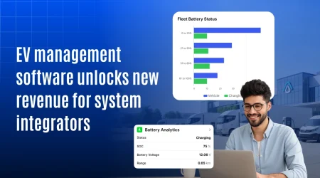
Why Augmented Reality GPS Tracking Based Navigation Matters for Scalable Fleet Operations
 (1)")
Fleet efficiency is no longer optional it’s critical to staying competitive. According to McKinsey, global parcel volumes could double by 2030, putting immense pressure on delivery networks. Even small inefficiencies have major consequences. For example, truck downtime can cost $448 to $760 per vehicle per day, and each failed delivery attempt adds an average of $7.44 in wasted resources.
Yet many fleets are still relying on static maps and outdated routing tools that can’t keep pace with modern delivery demands let alone dynamic traffic, multi-stop planning, or depot-specific guidance. This is where a new wave of innovation is changing the game: Augmented Reality (AR) GPS Navigation.
By combining real-time GPS tracking with AR-powered visual overlays, this technology enables drivers to see routes, alerts, and depot instructions directly on their screens or AR devices. This reduces errors, improves speed, and scales efficiency like never before. Whether you operate 20 vehicles or 2,000, AR GPS navigation gives you the edge to scale with accuracy, safety, and speed.
Curious how it works and why your competitors may already be deploying it?
Let’s explore how AR GPS navigation is becoming the backbone of scalable fleet operations.
What Is Augmented Reality GPS tracking based navigation?
Before we dive into benefits, let’s break it down:
-
GPS tracking continuously updates the vehicle’s exact location, speed, and direction in real time.
-
Augmented reality overlays visual instructions arrows, alerts, and route cues directly onto the road view via a screen or AR device.
By combining these two, the system delivers navigation that adjusts in real time based on live tracking data.
Why AR GPS navigation matters for scaling our fleet
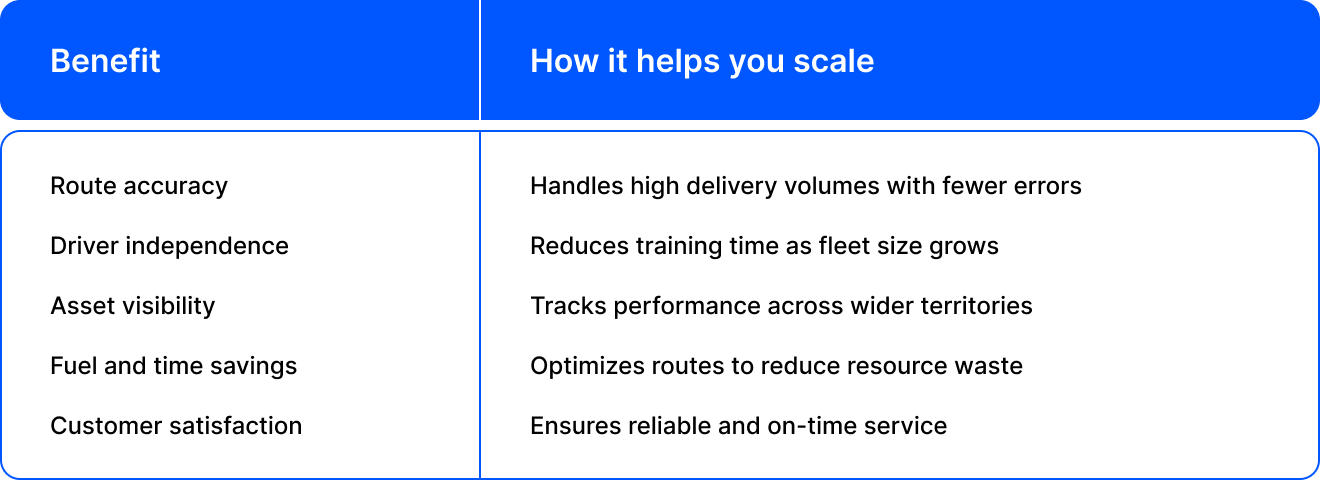
1. Real-time navigation that reduces delivery delays
- Displays live route overlays directly on the screen.
- Shows turn-by-turn directions in real-world view.
- Avoids confusion in complex locations like construction sites or business parks.
Impact: Timely deliveries, happier clients, and fewer support calls.
2. Streamlined last-mile delivery at scale
- Pinpoints exact drop-off points, entry gates.
- Reduces wasted time searching for access points.
- Helps new drivers navigate unfamiliar areas quickly.
Impact: More deliveries per shift and fewer failed attempts.
3. Smarter navigation in private yards and depots
- On large campuses, GPS alone isn’t enough.
- AR shows visual markers for docks, parking bays, or fueling points.
- Improves coordination inside warehouses, plants, or ports.
Impact: Smoother handoffs and less internal congestion.
4. Driver safety and compliance
- AR displays speed limits, hazard zones, and traffic signs visually.
- Encourages on-road discipline without distracting the driver.
- Useful for training new drivers with virtual guidance.
Impact: Safer roads and fewer policy violations.
5. Reducing downtime through AR-based maintenance
- Technicians can view AR overlays for diagnostics and repairs.
- GPS identifies the vehicle; AR guides repair steps.
- Supports remote assistance in the field.
Impact: Less downtime and faster issue resolution.
Industry use case
Logistics and delivery
- Boosts route optimization and driver visibility.
Construction fleets
- Helps drivers navigate vast work zones with onsite guidance.
Waste management
- Shows bin locations or pickup points with augmented visual cues.
Emergency services
- Offers real-time hazard alerts and smart routing under pressure.
Scaling challenges that AR GPS helps solve
- Difficulty managing multi-location fleets
- Rising costs due to detours or late deliveries
- High driver turnover and training needs
- Inaccurate delivery reports and low client trust
- Navigation issues in dense or restricted zones
AR GPS navigation provides scalable solutions that adapt as your operations expand.
Questions to ask before you implement AR GPS Navigation
- Does the solution integrate with your current fleet management software?
- Can drivers easily use it on smartphones or AR glasses?
- Does it offer real-time updates and route changes?
- Are reports generated for performance tracking?
- Can it handle multi-depot or multi-city fleets?
Future trends in AR-driven fleet navigation
Forward-looking fleets are already testing:
-
Windshield-based AR overlays for heads-up navigation
-
Voice-assisted routing combined with AR visuals
-
AI-enhanced route optimization tied to live tracking
-
Indoor-outdoor transitions for seamless depot and route navigation

Final thought
Scaling a fleet isn’t just about adding more vehicles it’s about making every route smarter, every driver faster, and every operation more precise. AR GPS tracking-based navigation delivers exactly that. It transforms how fleets move, adapt, and perform across changing environments and growing demands.
From seamless last-mile deliveries to real-time driver support, it gives fleet managers the control they need to grow without friction. The future of fleet operations is visual, dynamic, and data-driven. Now is the time to lead with technology that scales as fast as your business does.